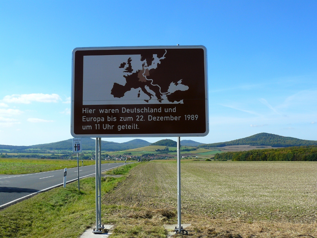
32 years ago, on 09 November 1989, the German domestic border between FRG and GDR was lifted (called BRD and DDR in German). After around 40 years, the Germans were re-united and the wall was removed from the so-called death zone. Over the past decades, the former border became a tourist attraction in Berlin. Now there are e.g. guided tours along the border crossings and the wall museum. But it’s often forgotten that the border went through the entirety of Germany. It was about 1,393 km, leading from Lübeck to the Ore Mountains. Now, natural, unaltered greenery takes the place of the former fences and walls – the Green Belt of Germany (“Grüne Band Deutschland”).
The Green Belt lives up to its name. It consists of 150 nature reserves with over 1,200 endangered species, which form together the largest biotope bond of Germany. An ideal destination for nature, animal and hiking lovers. Two long-distance runners, Michael Maier and Walter Eberhard, from Villingen-Schwenningen, Germany thought so too. 2009, the two became aware of the Green Belt through a TV documentary.
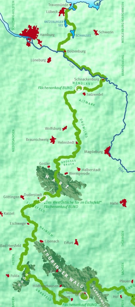
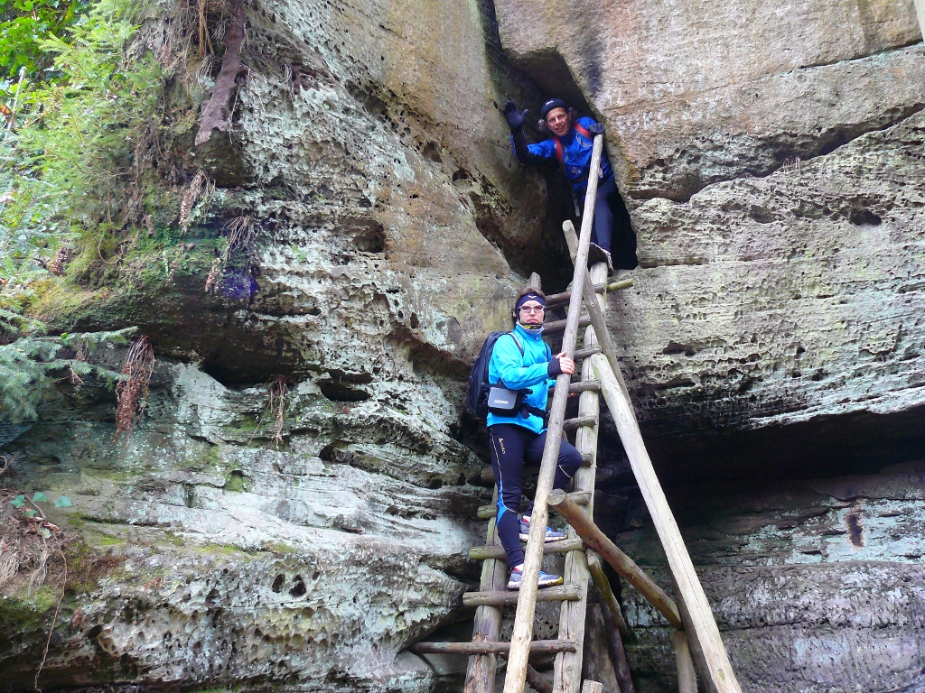
Over the duration of two years, they curiously explored the impressive educational nature and history trail. Even though the beeline distance from the Baltic Sea to the Czech border is 420 km, the border was 1.393 km long. The reason are the former dukedoms and principalities of the “German Confederation” from 1815. In five time blocks they spend about 31 days on the path. To cover the whole lengths, they walked around 40 km by foot daily.
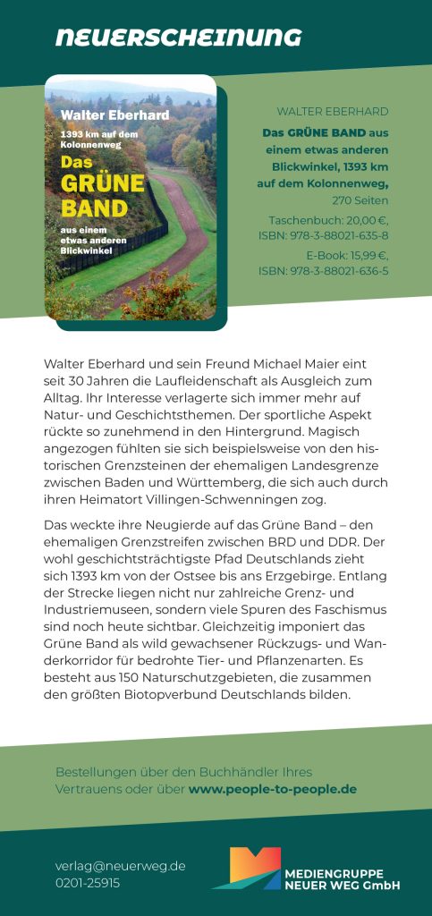
The two were amazed by the path steeped in history. It had so much to offer that they did not feel like they managed to see everything. This is why they visited the Green Belt an additional ten times and spend over 50 extra days in the fascinating natural landscape. During the trips they took around 7,000 pictures and they desired to give others an understanding of the Green Belt. In his book “Das Grüne Band aus einem etwas anderen Blickwinkel“ (“The Green Belt from another perspective”) Walter Eberhard writes about their multi-facetted experiences. It will be published 2021 by the Neuer Weg Verlag. He also offers lectures (more information below).
Interview
In this interview Walter Eberhard speaks about their exploration of the Green Belt and their development progress from sport competitions to Slow Travel.
What exactly is the Green Belt?
The Green Belt is the former border strip between the FRG and GDR. Immediately after the opening of the German domestic border, the BUND, an organization for environment and nature protection, started an initiative to protect the border strip. It was supposed to become a retreat area for animals and plants. This is how the death strip became a lifeline. The long-time plan is to create the largest forest and open landscape biotope bond system of Middle Europe from this area. Following through with it, a national park shall be developed from the Baltic Sea to the Vogtland.
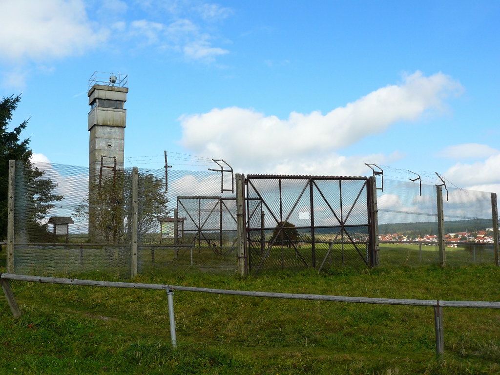
During the active border time, a metal fence ran between the two sites. The area directly located at the fence was kept plant free. Next to this death strip was an at least 500 meters wide, strictly surveilled “protection strip” with low-kept, steppe-like vegetation. In front of it was a five kilometers wide restricted zone in which traffic and industry was cut back immensely. On the Westside of the borderland there wasn’t really much happening either. In these areas animal and plant life could live and grow peacefully. Above all, endangered animals and pants benefited from it. The whole area of the Green Belt, which in this way was just exposed to much less human impact, is calculated to be about 8,000 km2. This corresponds to the half the area of Thuringia or around a quarter of Baden-Wuerttemberg.

Could you describe the landscape that you found there now during your explorations?
The landscape is really diverse. Due to the border, it was industrially a very weak area, which it has stayed until today. This means there are no major cities in the Green Belt. The villages, which were there, were demolished. The GDR force-relocated around 15,000 people that lived along the borderline. Because they lived at the border, they were automatically accused of helping people to cross the border and “treason of socialism”. Even if they were just working their jobs or on their farms and didn’t have anything to do with politics or fleeing people.
As a result, today, the Green Belt is a rural area without large cities, which due to its lengths is quite diverse. You can find everything from small, green valleys to desert-like areas like the glacial valley of the Elbe. At its main flow, the Elbe could also develop into a beautiful flood plain mainly because the border was there. Back then, the river was one of the most important German waterways. If the border area wouldn’t have been there, industry would have settled down at the Elbe. Therefore, the Green Belt is very natural and untouched. Often it is not even noticeable that the former German domestic border was there.
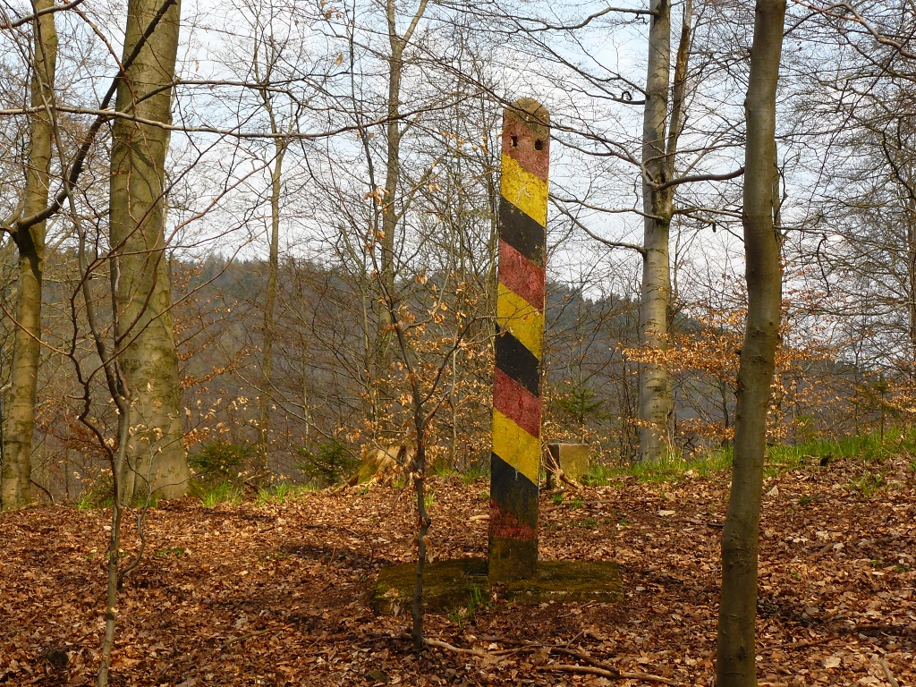
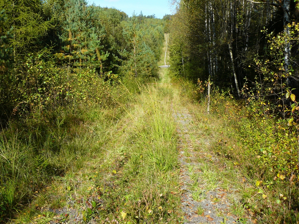
Solely at the patrol road (Kolonnenweg) is one able to properly imagine the former border. These are the streets made from concrete slabs with holes on which the vehicles patrolled to secure the border. Next to the patrol road was a control strip: a strip of sand, which showed fleeing activities by leaving footprints. Also, watchtowers can still be found there. But the patrol road was taken down in many areas. The residents didn’t want to perceive the border anymore and soughed to get rid of all traces. Partly, the areas are used by farmers as well and, for example, transformed to fields. At these corners the concrete slabs are stacked to piles at the side.
Parts of the green areas are publicly owned and other parts are private property. The reason for this is the „Mauergrundstücks-Gesetz“, a border property law, which was enacted in Berlin after the wall came down. This law made all areas along the border to building land. Of course, for farmers this was very beneficial to largen their economic areas. Today, without the protection of the nature reserves and biotopes there wouldn’t be so many green areas, especially forests. Therefore, it can only be called the Green Belt metaphorically – since so far it is an aspiration to declare it a biotope bond and preserve it as nature reserve.
Are many people walking the Green Belt?
The Green Belt is really big, it’s about 1,393 km. So, of course people are spread along the path. At popular locations you mainly meet lots of day tourists like for example at Point Alpha. In the times of Cold War, it was an important military base of the Americans. Today, it’s a memorial combined with a museum to remember the German partition. On a nice day, it’s pretty crowded there and the museum also serves as starting point for walks. But after such locations you are on your own again pretty quickly.
Are there many signs at the Green Belt?
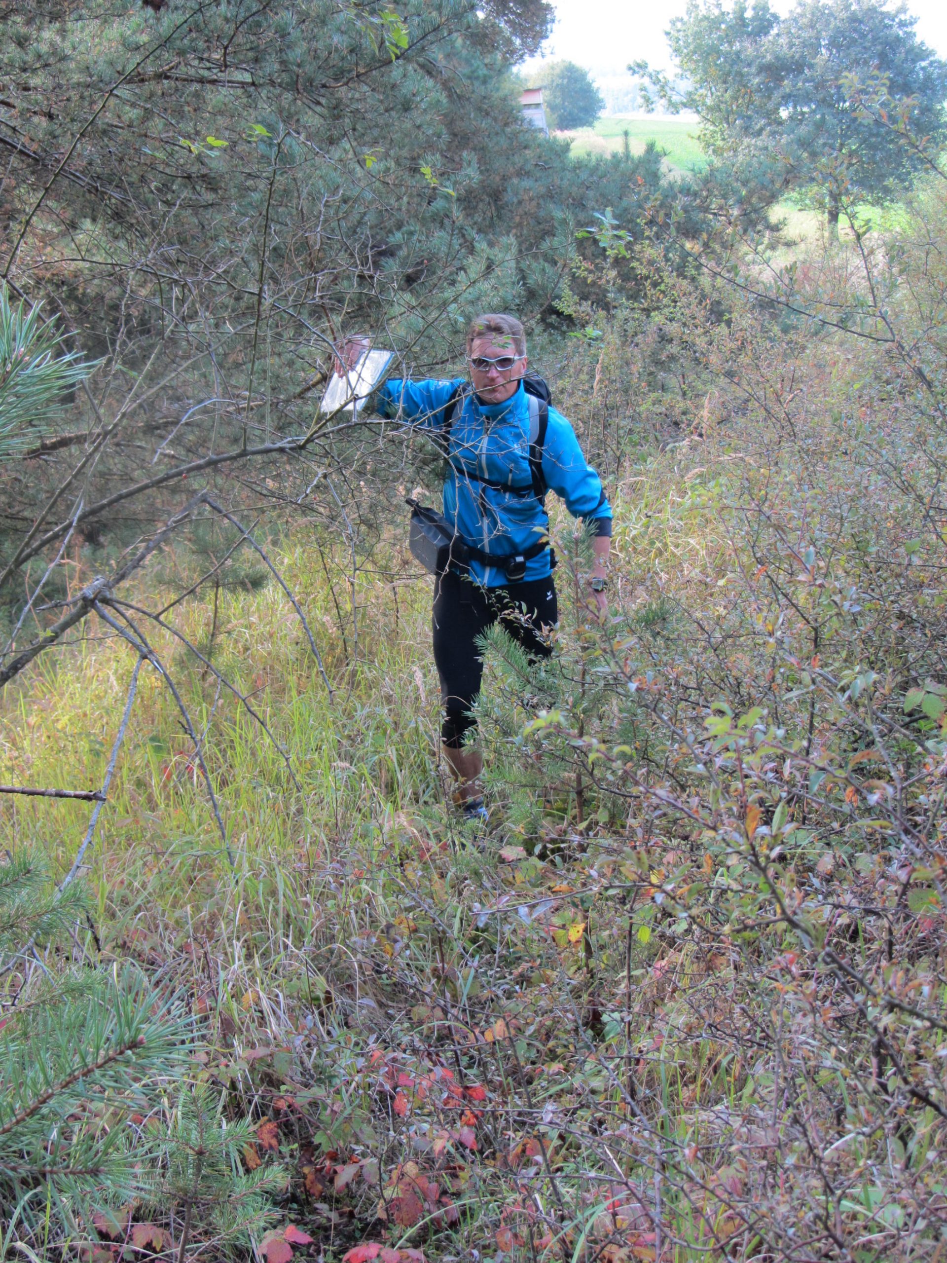
I would say it’s “inconsistently signposted”. At some places the signs are very good and the density of signs is high. At other parts of the Green Belt there are no signs at all and even the concrete slabs of the patrol roads, which could be used for orientation, are taken down. Some paths were totally over grown by plants in places because they weren‘t maintained. In such cases we used our map and oriented ourselves using clock towers or other points in the landscape that gave us a direction. I do not really know how this is organized, but assume that the county chapter or village is assigned to the signposting. And then of course, it is implemented very inconsistently without proper regulations.
Is there an infrastructure for hikers? Are there for example water refill stations, shops or restaurants along the way?
No, surprisingly the hiking infrastructure at the Green Belt is not really developed. There are no water refill options and almost no restaurants or offers that are focused on people, which are wandering along the nature path. We always filled up our bottles in the morning at our accommodation and just ate some muesli bars over the day. Dinner, again, we had at the accommodation for the next night. The rooms, small guest houses and pensions, were booked ahead. So we always knew where we would sleep the next day.
The Green Belt is full of history. Is the former border area developed for culturally interested people?
Yes, actually there are some museums and information offers along the Green Belt – I would guess there are about 15 museums. They are focused mainly on military topics like at Point Alpha, where the old borders with fence and watchtowers are preserved and accessible. These are often open land museums in which the border area looks like it did back then. Of course, these museums are not named using the term “Green Belt”, but are called for example Grenzmuseum Schifflersgrund, Grenzlandmuseum Eichsfeld or Gedenkstädte Deutsche Teilung Marienborn.
Additionally, at Point Alpha, there are the old U.S. barracks, which can be visited. There they show pictures of how the border was secured, how it looked at night time etc. The exhibitions at these places are usually very simple and analogue, without technical elements like movies or interactive stations. But I found it really suitable because it also reflected the time back then. It is also very impressive when individual stories are exhibited. Because even if today we call the border a “stroke of luck for nature”, about 1,000 people died while trying to cross the border illegally.
And then there are the small municipal museums, where a village just placed a museum into a municipal owned house. You also see a lot of information panels along the way, which were created by historical clubs. Some people just want to preserve the knowledge about the border and the time back then.

Which places did you visit during your trips?
We went to Point Alpha and some of the municipal museums. But then our interest shifted to mining and we visited lots of mines and technical memorials. What we found really interesting was for example the slate mining in Lehesten at the Thuringian Forest. The region is famous for its „Blue Gold“, a high-quality type of slate, which through its mineral composition glistens blue. There is no network of these museums and memorials by the way, which would create a map with an overview of the cultural offers. You can find a Green Belt map from the BUND online. But this map mainly focuses on ecology – forests, biotopes and nature parks.
How did you experience the former border today? Did you talk to the people on-site, so to actual contemporary witnesses?
Michael and I were very open during the travel. We wanted to get in contact with people and we approached many directly. What was especially interesting to us were the people who made a living from the border situation. There were information rides, which were initiated by the Agency for Civic Education, were people took bus rides that crossed the borders. On board were travel guides who told stories about the different stops along the way. This was strongly used for anti-communist agitation by the FRG.
Due to this, there were many taxi and bus entrepreneurs at the border area that built their businesses on the border travels. When the wall came down, suddenly there weren’t any information rides anymore and the entrepreneurs lost their source of income. For example, we met a taxi driver who back then owned a taxi company that went bankrupt. For him this stress also caused serious health problems.
Another very impressive talk we had with an older lady who back then lived in the GDR. It turned out that in time of National Socialism she and her brother survived the concentration camp Auschwitz. So, she had not just lived through the division of Germany, but also endured incredible things during the Nazi time. Later, her brother was shot when he tried to cross the border in the Western direction. At the beginning of our trip, we were not prepared for these kind of encounters.
What does the Green Belt mean for Germany in your opinion?
My personal aspiration is to promote the Green Belt, because many don’t know how interesting and historically rich it is. It doesn’t just reflect the former separation of Germany – the wall was de facto a crime by the GDR on their own people. But there is also a former concentration camp (Dora Mittelbau) and two UNESCO World Culture Heritage sites along the route – the old town of Lübeck and the Oberharzer water management (Oberharzer Wasserwirtschaft). The preservation of the Green Belt is very important for the historical awareness of the Germans, especially regarding National Socialism and the Second World War. It’s mentioned too rarely that fascism under Hitler built the base for the division of Germany. Such a thing should be never repeated. Therefore, the Green Belt is also a memorial site.
These travel really changed my perspective on nature and history. It taught me that nature doesn’t really need us. It’s pretty well off alone without humans. In my opinion, the Green Belt should be put under progress conservation (more see grey box below). This is a nature protection strategy from the forest industry where humans don’t intervene into the natural progresses of the ecosystem. We humans should become students of nature and shouldn’t try to dictate nature how it’s supposed to appear. Against this background, I share the belief with the BUND that the whole Green Belt should be protected. It has gotten to the point to be declared to a natural monument and to be integrated in the list of UNESCO World Heritage.
What are your thoughts about Slow Travel? Do you think you are a Slow Traveler?
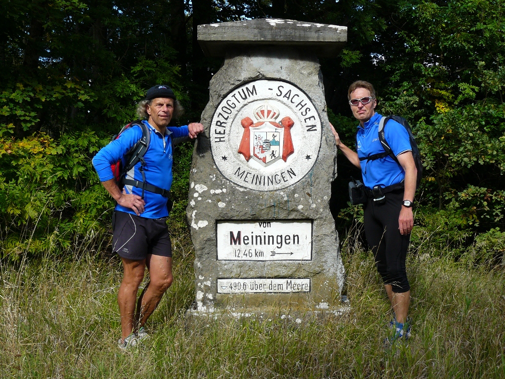
I just learned about the term from your blog Travel Slowly. But I would think that Michael and I have been Slow Travelers for a long time. We started as long-distance runners. As runners we tried out a lot of different things. But the rush after the clock, meaning running on time, became boring for us. So, we reduced our speed. And suddenly we took in the nature around much more. Subsequently, we became hobby landscape explorers. For example, we hiked the border of Baden-Wuerttemberg, which is up-to today marked with boundary stones. We were also very amazed to learn about the changes of rocks. Our hiking let to a distance to the daily life and brought us relaxation – far away from the stress, rush and time pressure. This mindset also accompanied us during the travels along the Green Belt.
Reading tip: 28 years ago in Berlin, the GDR and FRG were separated by the Berlin Wall (1962 – 1989). If you would like to find out more about the German domestic border in the German capital, you can check out the website Chronicle of the Berlin Wall.
Lecture “Green Belt”
Walter Eberhard offers lectures about the Green Belt (in German). You can book them via the following e-mail address:
info(ä t )bajus-ausdauerschule.de
(unpaid advertising)
More about progress conservation by Walter Eberhard
The earth is 4.5 Billions years old. The human is changing the surface with the so-called cultivated landscape since just about around 10,000 years. Does this not raise the question how earth could be well off without humans? Nature developed its own progresses, which are just researched by humans to some extent.
Due to lacking scientific findings, the idea was quite common that earth is shapable by humans at will. Let’s take for example the baroque gardens where many gardeners were working to dictate nature the humans’ will. Up to this day, in current language, wild herbs are named weeds, insects are vermin and pesticides are gently called plant protection products. The forest and field monocultures are the most extreme, as well as the morbid holding-on to environmental hostile mobility systems.
Everything is focused on short-timed economic targets, mostly in large companies. This led the planet into the climate crises. Just slowly the awareness prevails that humans have to study the natural progresses to balance the unity of human and nature. This is called “progress conservation”. Only then, the climate catastrophe can be stopped.
1992, the Fourth World Congress on National Parks and Protected Areas in Caracas formulated an important thought: “Since millions of years, nature developed independent of humans. To this day, it can exist without the care of humans. There are plenty of dynamic progresses constantly in natural cohabitation.”[1]
[1] Bibelriether, Hans (2017): Natur Natur sein lassen, Freyung, p. 135.
Article by Anika Neugart.
Update: The book of Walter Eberhard has been published
